|
Clarence Valley Council (NSW) - Forster, Yamba and TuggerahClarence Valley Council engaged Schlencker Mapping to undertake floor level measurements for approximately 6000 buildings in Forster, Yamba and several other small towns in the LGA. An additional 1300 buildings in the towns of Iluka and Ulmarra were added as an extension to the main dataset. In addition to levels captured using the mobile scanner, all habitable rural buildings outside towns had eave and ground levels captured using Aerial LiDAR with estimated floor levels calculated from these measurements. Rockhampton Regional Council - South Rockhampton and Mount Morgan1. To assist in flood studies along the Fitzroy River and several smaller creeks, Council requested the mobile scanning and floor level extraction for approximately 6200 properties. Along with the floor levels and building images, the captured pointcloud was also supplied in LAS format.2. To assist in flood studies in South Rockhampton and the town of Mount Morgan, Council requested the mobile scanning and floor level extraction for approximately 2100 properties. Along with the floor levels and building images, the captured pointcloud was also supplied in LAS format.
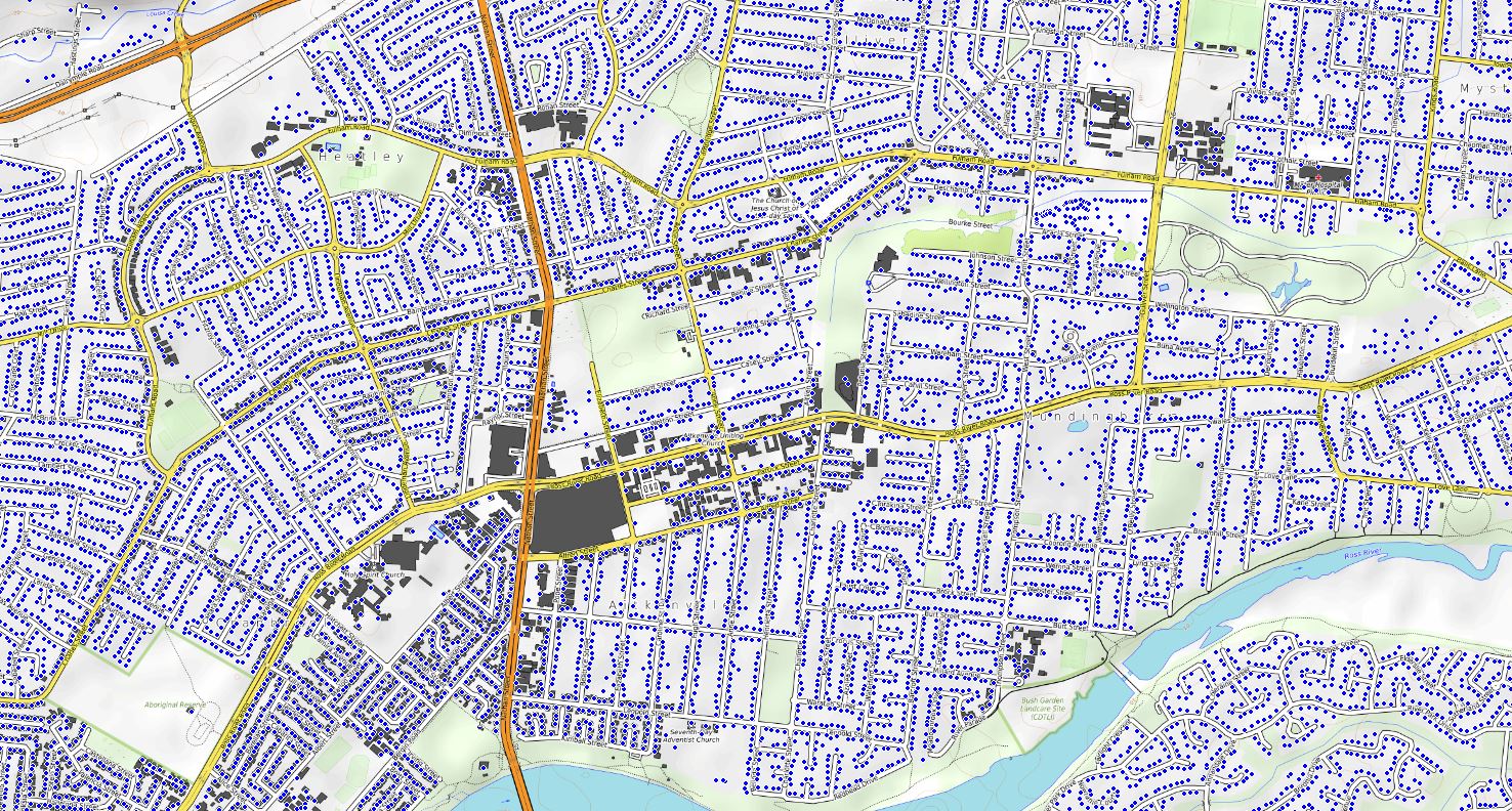
Townsville City Council - TownsvilleFloor level extraction of approximately 69,000 buildings, which included scanning of 1400 km of roads throughout the urban areas of Townville City Council LGA. The data was used for flood analysis and planning as well as for the creation of a city wide 3D model.
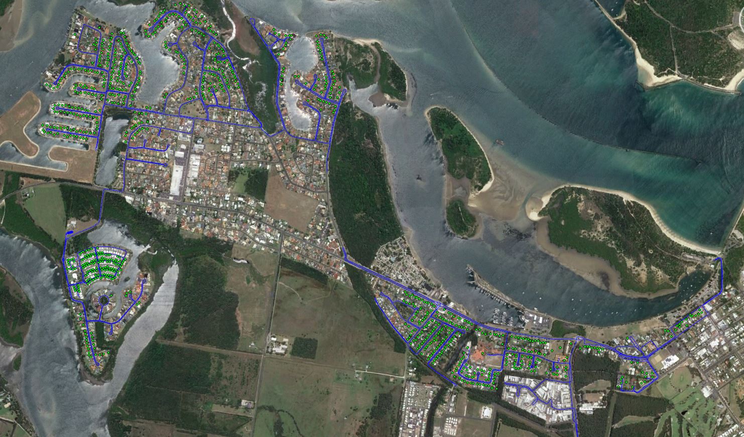
Bundaberg Regional Council - Bundaberg, Gin Gin and Coastal Areas1. Habitable floor levels were required to validate and better understand the impact of flood water surface levels from flood modelling on residential properties. Almost 5000 floor levels were captured. Also supplied were the geo-referenced images of each building with floor level pickup location shown.2. Nearly 3300 floor levels captured throughout numerous coastal areas in the Bundaberg LGA. Geo-referenced .JPG images showing floor level location as well as 360° street level images were also supplied as part of the project.
|
At Schlencker Mapping we are dedicated to helping you meet your business objectives. To do this we will:
We invite you to arrange a time to meet with us to discuss your individual requirements. Schlencker Mapping has completed numerous other floor level projects including:
|
| www.schmap.com.au © 2021 |